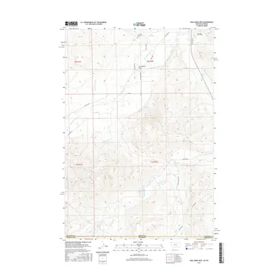
2017 Map of Pass Creek West
USGS Topo · Published 2017About this map
Wyola sits at the northern edge of this high-plains landscape, where the agricultural infrastructure of the Crow Indian Reservation meets the foothills of the Bighorn Mountains. The map details an intricate network of water management features essential to the region's ranching and farming history, including the Bozeman Trail Ditch, the Upper Little Bighorn Canal Number Two, and the Campbell Belken Ditch. These waterways parallel the course of the Little Bighorn River as it flows north toward Wyola. In the southern half of the quadrangle, the terrain rises into the dissected ridges of the Big Horn and Sheridan county line, where landmarks like Columbus Peak and W Pass Cr define the headwaters of the drainage system. The presence of the Brightwing Cem near the river valley provides a specific point of interest for those researching local family histories in this borderland between Montana and Wyoming.
Find a feature on this map
1 named feature on this map. Tap any name to fly to it.
Don’t see what you’re looking for? This feature index may not catch every label — zoom into the map to look around manually.
Map Details
Editions of this 2017 Pass Creek West Map
This is the sole edition of this map. No revisions or reprints were ever made.
Other maps of this area

1894 · Rosebud
USGS Topo · 1:125,000

1894 · St. Xavier
USGS Topo · 1:125,000

1895 · Dayton
USGS Topo · 1:125,000

1898 · Bald Mountain
USGS Topo · 1:125,000

1901 · Rosebud
USGS Topo · 1:125,000

1901 · Dayton
USGS Topo · 1:125,000

1901 · St. Xavier
USGS Topo · 1:125,000

1901 · Bald Mountain
USGS Topo · 1:125,000

1954 · Hardin
USGS Topo · 1:250,000

1955 · Sheridan
USGS Topo · 1:250,000