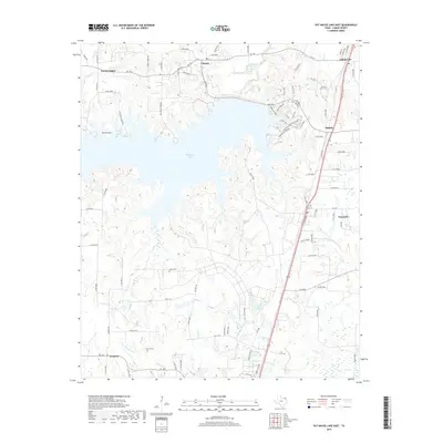
2019 Map of Pat Mayse Lake East
USGS Topo · Published 2019About this map
Pat Mayse Lake dominates this portion of Lamar County, where the water has carved a complex shoreline of inlets like Buzzard Hollow and Sanders Cove. This modern survey reflects the established recreational and rural character of the region, anchored by the community of Chicota to the north and Powderly to the southeast. The map provides significant value for genealogists and local historians, pinpointing several small rural cemeteries such as Casey Cem and McEwin Cem located west of Lamar Lake. The transportation network is defined by state routes and a grid of county roads that connect outlying settlements like Forest Chapel, Forest Point, and Caviness. Along the northern edge, Arthur City sits near the winding course of Sanders Creek, marking a transition toward the Red River valley.
Find a feature on this map
93 named features on this map. Tap any name to fly to it.
Don’t see what you’re looking for? This feature index may not catch every label — zoom into the map to look around manually.
Map Details
Editions of this 2019 Pat Mayse Lake East Map
This is the sole edition of this map. No revisions or reprints were ever made.
Other maps of this area

1903 · Paris
USGS Topo · 1:125,000

1948 · Grant
USGS Topo · 1:62,500

1948 · Paris
USGS Topo · 1:62,500

1949 · Grant
USGS Topo · 1:62,500

1949 · Paris
USGS Topo · 1:62,500

1951 · Slate Shoals
USGS Topo · 1:24,000

1951 · Shoals
USGS Topo · 1:24,000

1953 · Texarkana
USGS Topo · 1:250,000

1956 · Texarkana
USGS Topo · 1:250,000

1964 · Blossom
USGS Topo · 1:24,000