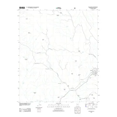
2012 Map of Patagonia
USGS Topo · Published 2012About this map
The Patagonia settlement and its surrounding cattle country define this corner of Santa Cruz County in the early 21st century. The landscape is a network of named canyons and springs, including Temporal Gulch and Mata Siete Spring, carved into the terrain surrounding Salero Mountain and Squaw Peak. Local heritage is anchored by established family operations like Weatherhead Ranch, Hard Luck Ranch, and Gatlin Ranch, which sit alongside the waters of Sonoita Cr.
Find a feature on this map
51 named features on this map. Tap any name to fly to it.
Don’t see what you’re looking for? This feature index may not catch every label — zoom into the map to look around manually.
Map Details
Editions of this 2012 Patagonia Map
This is the sole edition of this map. No revisions or reprints were ever made.
Other maps of this area

1904 · Patagonia
USGS Topo · 1:125,000

1905 · Patagonia
USGS Topo · 1:125,000

1905 · Nogales
USGS Topo · 1:125,000

1922 · Agus Caliente
USGS Topo · 1:62,500

1932 · Lochiel
USGS Topo · 1:62,500

1932 · Elgin
USGS Topo · 1:62,500

1933 · Calabasas
USGS Topo · 1:62,500

1940 · Elgin
USGS Topo · 1:62,500

1947 · Elgin
USGS Topo · 1:62,500

1948 · Sonoita
USGS Topo · 1:24,000