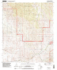
1996 Map of Patagonia
USGS Topo · Published 2002About this map
Mining operations and remote ranching outposts define this stretch of the Santa Rita Mountains, where the landscape is etched with the remnants of late 20th-century extraction. Heavy concentrations of silver and lead claims like the Salero Mine and the Mansfield Group dominate the northern terrain, interspersed with local landmarks like the Ranger Station and several water sources including Dripping Spring and Johnson Spring. The map reveals the intricate drainage system of the high desert, from Temporal Gulch to the seasonal flow of Sonoita Creek.
Find a feature on this map
74 named features on this map. Tap any name to fly to it.
Don’t see what you’re looking for? This feature index may not catch every label — zoom into the map to look around manually.
Map Details
Editions of this 1996 Patagonia Map
This is the sole edition of this map. No revisions or reprints were ever made.
Other maps of this area

1904 · Patagonia
USGS Topo · 1:125,000

1905 · Patagonia
USGS Topo · 1:125,000

1905 · Nogales
USGS Topo · 1:125,000

1922 · Agus Caliente
USGS Topo · 1:62,500

1932 · Lochiel
USGS Topo · 1:62,500

1932 · Elgin
USGS Topo · 1:62,500

1933 · Calabasas
USGS Topo · 1:62,500

1940 · Elgin
USGS Topo · 1:62,500

1947 · Elgin
USGS Topo · 1:62,500

1948 · Sonoita
USGS Topo · 1:24,000