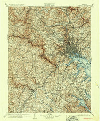
1908 Map of Patapsco
USGS Topo · Published 1934About this map
The inner harbor and industrial waterfront of Baltimore anchor this early 20th-century survey, revealing a landscape defined by its maritime connections and rail infrastructure. Guarding the approaches to the city are the historic Fort McHenry and the island battery of Fort Carroll. Beyond the urban core, the map traces the convergence of major turnpikes such as the Frederick Turnpike and York Turnpike, which link the city to outlying towns like Towson, Catonsville, and Ellicott City.
Find a feature on this map
278 named features on this map. Tap any name to fly to it.
Don’t see what you’re looking for? This feature index may not catch every label — zoom into the map to look around manually.
Map Details
Editions of this 1908 Patapsco Map
4 editions found

Other maps of this area

1890 · Mt. Vernon
USGS Topo · 1:125,000

1891 · Mt. Vernon
USGS Topo · 1:125,000

1892 · Laurel
USGS Topo · 1:62,500

1892 · Ellicott
USGS Topo · 1:62,500

1892 · Owensville
USGS Topo · 1:62,500

1892 · Annapolis
USGS Topo · 1:62,500

1893 · North Point
USGS Topo · 1:62,500

1893 · Gunpowder
USGS Topo · 1:62,500

1893 · Frederick
USGS Topo · 1:125,000

1894 · Ellicott
USGS Topo · 1:62,500