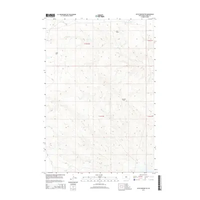
2015 Map of Patch Skin Buttes
USGS Topo · Published 2015About this map
Patch Skin Buttes and the surrounding high plains of Dewey County dominate this topographic study, where the landscape is defined by its dramatic relief and intermittent watercourses. In this section of South Dakota, the drainage patterns of Buffalo Cr and Swift Bird Cr carve through the terrain, illustrating the natural erosion that has shaped the regional buttes. The map shows a sparse network of roads, notably Bia-810 and Cr-14f, which serve as the primary conduits through this grazing country. Landform features like Twin Buttes and Coffee Butte provide clear vertical landmarks in an otherwise open horizon, while the E Fork No Mouth Cr indicates the complex hydrology of the Missouri River watershed's upper reaches.
Find a feature on this map
12 named features on this map. Tap any name to fly to it.
Don’t see what you’re looking for? This feature index may not catch every label — zoom into the map to look around manually.
Map Details
Editions of this 2015 Patch Skin Buttes Map
This is the sole edition of this map. No revisions or reprints were ever made.
Other maps of this area

1951 · Virginia
USGS Topo · 1:24,000

1951 · Promise
USGS Topo · 1:24,000

1953 · McIntosh
USGS Topo · 1:250,000

1958 · McIntosh
USGS Topo · 1:250,000

1968 · Moreau
USGS Topo · 1:24,000

1968 · Moreau SE
USGS Topo · 1:24,000

1969 · Patch Skin Buttes SW
USGS Topo · 1:24,000

1969 · Four Bear Creek
USGS Topo · 1:24,000

1969 · Patch Skin Buttes SE
USGS Topo · 1:24,000

1970 · Patch Skin Buttes
USGS Topo · 1:24,000