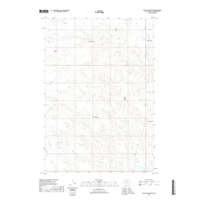
2017 Map of Patch Skin Buttes
USGS Topo · Published 2017About this map
Patch Skin Buttes and the surrounding high ground dominate this portion of Dewey County, where the landscape transitions into the drainage basins of the Missouri River system. The map captures a high-elevation plateau characterized by prominent landmarks such as Twin Buttes and Coffee Butte, which serve as significant navigational points in this open terrain. Water features define the lower elevations, with the headwaters of Buffalo Cr, Swift Bird Cr, and E Fork No-Mouth Cr carving out the topography. In the southeastern corner, the reach of Lake Oahe is visible, reflecting the impact of mid-century Missouri River projects on the regional hydrology. Transportation is limited to a sparse network of Bureau of Indian Affairs routes, including Bia Hwy 8 and Bia Hwy 7, which provide the primary access through these remote ranchlands and tribal territories.
Find a feature on this map
15 named features on this map. Tap any name to fly to it.
Don’t see what you’re looking for? This feature index may not catch every label — zoom into the map to look around manually.
Map Details
Editions of this 2017 Patch Skin Buttes Map
This is the sole edition of this map. No revisions or reprints were ever made.
Other maps of this area

1951 · Virginia
USGS Topo · 1:24,000

1951 · Promise
USGS Topo · 1:24,000

1953 · McIntosh
USGS Topo · 1:250,000

1958 · McIntosh
USGS Topo · 1:250,000

1968 · Moreau
USGS Topo · 1:24,000

1968 · Moreau SE
USGS Topo · 1:24,000

1969 · Patch Skin Buttes SW
USGS Topo · 1:24,000

1969 · Four Bear Creek
USGS Topo · 1:24,000

1969 · Patch Skin Buttes SE
USGS Topo · 1:24,000

1970 · Patch Skin Buttes
USGS Topo · 1:24,000