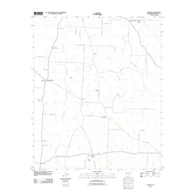
2011 Map of Patmos
USGS Topo · Published 2011About this map
Patmos sits at the base of this Hempstead County landscape, where rural life is defined by the winding course of Little Bodcau Creek and its many tributaries. The area is marked by numerous family and community burial grounds, including Patmos Cemetery, Hatch Cemetery, and Macedonia Cemetery, which serve as vital landmarks for genealogists tracing local family roots. A network of rural routes like Patmos Rd and Old Log Rd connects small settlements such as Evening Shade, Coler, and New Hope.
Find a feature on this map
58 named features on this map. Tap any name to fly to it.
Don’t see what you’re looking for? This feature index may not catch every label — zoom into the map to look around manually.
Map Details
Editions of this 2011 Patmos Map
This is the sole edition of this map. No revisions or reprints were ever made.
Other maps of this area

1901 · Gurdon
USGS Topo · 1:125,000

1951 · Patmos
USGS Topo · 1:24,000

1951 · Sheppard
USGS Topo · 1:24,000

1951 · Spring Hill
USGS Topo · 1:24,000

1951 · Hope
USGS Topo · 1:24,000

1952 · Old Town
USGS Topo · 1:24,000

1952 · Boyd Hill
USGS Topo · 1:24,000

1953 · El Dorado
USGS Topo · 1:250,000

1957 · El Dorado
USGS Topo · 1:250,000

1958 · El Dorado
USGS Topo · 1:250,000