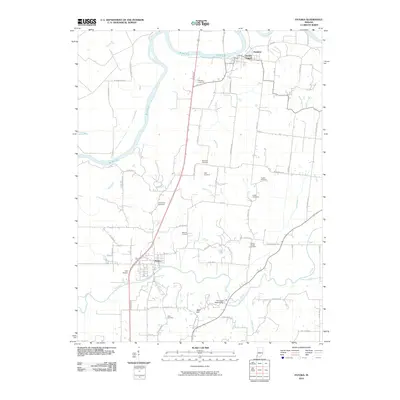
2022 Map of Patoka
USGS Topo · Published 2022About this map
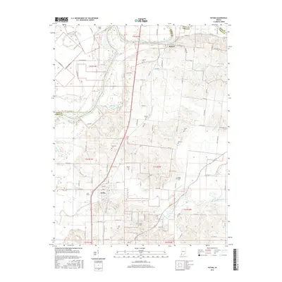
Hazleton and Patoka anchor this landscape where the White River and Patoka River wind through the borderlands of Knox and Gibson counties. The terrain is defined by a complex network of drainage ditches, including Thompson Ditch, Hull Ditch, and Trippet Ditch, which manage the low-lying areas near Long Pond. For genealogists and local historians, this survey is exceptionally dense with family-named burial sites, such as Barnett, Morrison, and Milburn cemeteries, reflecting generations of rural settlement. Aviation history is noted at Hull Airport near the center of the quadrangle, while Bald Hill provides a prominent topographic reference point south of the river. The map also traces the modern influence of Interstate 64 as it intersects the older regional road network, illustrating the evolution of transport in this corner of southwestern Indiana.
Find a feature on this map
116 named features on this map. Tap any name to fly to it.
Don’t see what you’re looking for? This feature index may not catch every label — zoom into the map to look around manually.
Map Details
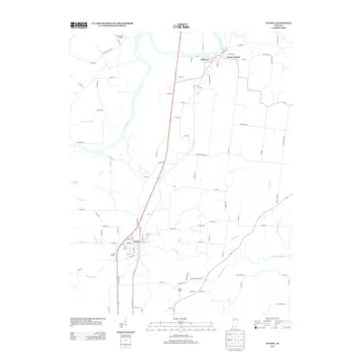
Editions of this 2022 Patoka Map
This is the sole edition of this map. No revisions or reprints were ever made.
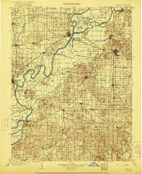
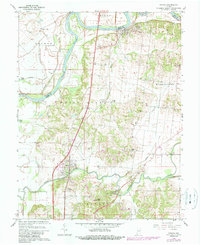
Historical Maps of Patoka Through Time
7 maps found