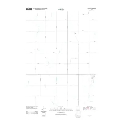
2013 Map of Paton
USGS Topo · Published 2013About this map
Paton sits at the intersection of local routes in this Iowa agricultural landscape, serving as a primary hub for the surrounding township. The terrain is defined by a dense network of waterways that drain the prairie, including the branching paths of W Buttrick Cr and E Buttrick Cr. To the north, the small settlement of Lena is situated along the corridor of Fairbanks Ave, reflecting the traditional dispersed settlement pattern of the region. The map captures a detailed grid of rural roads and county avenues that link isolated farmsteads with the larger community of Paton. Small drainage features like Lost Br and Devils Fork carve through the flat topography, illustrating the natural water management systems critical to this farming heartland.
Find a feature on this map
36 named features on this map. Tap any name to fly to it.
Don’t see what you’re looking for? This feature index may not catch every label — zoom into the map to look around manually.
Map Details
Editions of this 2013 Paton Map
This is the sole edition of this map. No revisions or reprints were ever made.
Other maps of this area

1923 · Lehigh
USGS Topo · 1:62,500

1951 · Ogden
USGS Topo · 1:62,500

1954 · Fort Dodge
USGS Topo · 1:250,000

1957 · Fort Dodge
USGS Topo · 1:250,000

1958 · Fort Dodge
USGS Topo · 1:250,000

1962 · Jefferson
USGS Topo · 1:62,500

1965 · Farnhamville
USGS Topo · 1:24,000

1965 · Gowrie
USGS Topo · 1:24,000

1965 · Harcourt
USGS Topo · 1:24,000
1982 · Lanyon
USGS Topo · 1:24,000