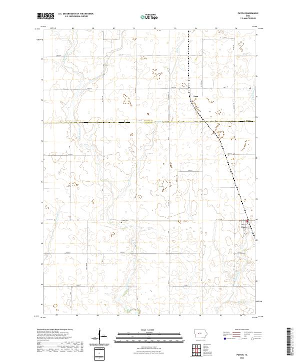
2022 Map of Paton
USGS Topo · Published 2022About this map
Paton anchors the southeastern corner of this modern topographic study, where the landscape is defined by the headwaters of numerous small tributaries. The town is situated at a point of relative elevation above the Devils Fork and E Buttrick Cr. Further north, the unincorporated community of Lena sits near the county line, illustrating the sparse but persistent settlement patterns of this agrarian region. The map highlights the intricate drainage network crossing the Iowa prairie, featuring labels for W Buttrick Cr, Tank Pond Cr, and Lost Br. For local history and genealogy, the Dawson Cem provides a specific point of interest along Co HWY e18. The rectangular survey system is clearly visible, with a grid of gravel and paved roads like 370th ST and 150th ST partitioning the land into uniform sections across the Webster Co Greene Co boundary.
Find a feature on this map
28 named features on this map. Tap any name to fly to it.
Don’t see what you’re looking for? This feature index may not catch every label — zoom into the map to look around manually.
Map Details
Editions of this 2022 Paton Map
This is the sole edition of this map. No revisions or reprints were ever made.
Other maps of this area

1923 · Lehigh
USGS Topo · 1:62,500

1951 · Ogden
USGS Topo · 1:62,500

1954 · Fort Dodge
USGS Topo · 1:250,000

1957 · Fort Dodge
USGS Topo · 1:250,000

1958 · Fort Dodge
USGS Topo · 1:250,000

1962 · Jefferson
USGS Topo · 1:62,500

1965 · Farnhamville
USGS Topo · 1:24,000

1965 · Gowrie
USGS Topo · 1:24,000

1965 · Harcourt
USGS Topo · 1:24,000
1982 · Lanyon
USGS Topo · 1:24,000