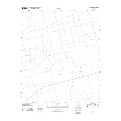
2010 Map of Patricia SW
USGS Topo · Published 2010About this map
Brushy Lake serves as a central hydrologic landmark in this arid portion of Gaines County, where the landscape is defined by the ephemeral passage of McKenzie Draw. The terrain reflects a strictly organized agricultural and ranching grid, dominated by a network of rural routes such as Co Rd 451 and Ranch Rd 2051 that facilitate movement across the Llano Estacado. This 2010 survey by the U.S. Geological Survey illustrates the modern configuration of property boundaries and local transit ways in West Texas, including Co Rd 428 and Co Rd 434. The sparse distribution of named features underscores the rural character of the region, where water sources and drainage patterns like McKenzie Draw dictate the placement of human infrastructure.
Find a feature on this map
9 named features on this map. Tap any name to fly to it.
Don’t see what you’re looking for? This feature index may not catch every label — zoom into the map to look around manually.
Map Details
Editions of this 2010 Patricia SW Map
This is the sole edition of this map. No revisions or reprints were ever made.
Other maps of this area

1954 · Hobbs
USGS Topo · 1:250,000

1958 · Hobbs
USGS Topo · 1:250,000

1966 · Wolcott Ranch
USGS Topo · 1:24,000

1966 · Scharbauer Ranch
USGS Topo · 1:24,000

1970 · Patricia SW
USGS Topo · 1:24,000

1970 · Patricia
USGS Topo · 1:24,000

1970 · McKenzie Lake SE
USGS Topo · 1:24,000

1970 · Sand
USGS Topo · 1:24,000

1970 · McKenzie Lake
USGS Topo · 1:24,000
1970 · Patricia NE
USGS Topo · 1:24,000