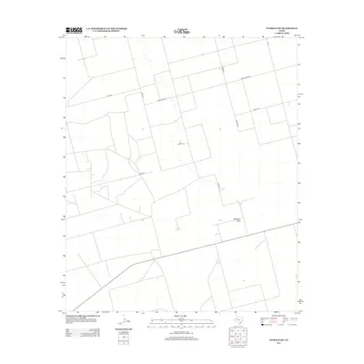
2012 Map of Patricia SW
USGS Topo · Published 2012About this map
Mckenzie Draw and Brushy Lake define the hydrology of this southwestern portion of the Patricia region in Gaines County. The landscape is characterized by a precise grid of rural thoroughfares, reflecting the systematic land division common in West Texas. Transport across this agricultural terrain is supported by a network of county roads including Co Road 428, Co Rd 451, and Co Road Dd, while Ranch Road 2051 provides a primary east-west corridor. This 2012 survey illustrates the intersection of natural drainage features with human-imposed boundaries, where local roads such as Co Road Ee and Co Road Aa navigate around the subtle depressions of the draws and lake beds.
Find a feature on this map
10 named features on this map. Tap any name to fly to it.
Don’t see what you’re looking for? This feature index may not catch every label — zoom into the map to look around manually.
Map Details
Editions of this 2012 Patricia SW Map
This is the sole edition of this map. No revisions or reprints were ever made.
Other maps of this area

1954 · Hobbs
USGS Topo · 1:250,000

1958 · Hobbs
USGS Topo · 1:250,000

1966 · Wolcott Ranch
USGS Topo · 1:24,000

1966 · Scharbauer Ranch
USGS Topo · 1:24,000

1970 · Patricia SW
USGS Topo · 1:24,000

1970 · Patricia
USGS Topo · 1:24,000

1970 · McKenzie Lake SE
USGS Topo · 1:24,000

1970 · Sand
USGS Topo · 1:24,000

1970 · McKenzie Lake
USGS Topo · 1:24,000
1970 · Patricia NE
USGS Topo · 1:24,000