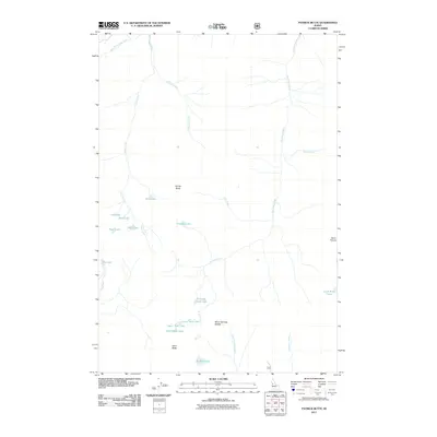
2011 Map of Patrick Butte
USGS Topo · Published 2011About this map
Patrick Butte and Hard Butte define the high elevations of this Idaho landscape, where a dense network of glacial basins and alpine water bodies forms the headwaters for several major drainages. This high-country terrain is characterized by a series of distinct lakes, including Goat Lake, Paradise Lake, and the cluster of Lava Butte Lakes, which feed into the rugged canyon systems of Partridge Creek and Hell Creek. The absence of roads or settlements across the sheet highlights the undeveloped nature of the region during this 2011 survey.
Find a feature on this map
26 named features on this map. Tap any name to fly to it.
Don’t see what you’re looking for? This feature index may not catch every label — zoom into the map to look around manually.
Map Details
Editions of this 2011 Patrick Butte Map
This is the sole edition of this map. No revisions or reprints were ever made.
Other maps of this area

1938 · Riggins
USGS Topo · 1:96,000

1945 · Riggins
USGS Topo · 1:125,000

1955 · Grangeville
USGS Topo · 1:250,000

1959 · Grangeville
USGS Topo · 1:250,000

1963 · Indian Mountain
USGS Topo · 1:24,000

1963 · Black Tip
USGS Topo · 1:24,000

1963 · Hershey Point
USGS Topo · 1:24,000
1963 · Hazard Lake
USGS Topo · 1:24,000
1964 · Patrick Butte
USGS Topo · 1:24,000

1964 · Riggins
USGS Topo · 1:24,000