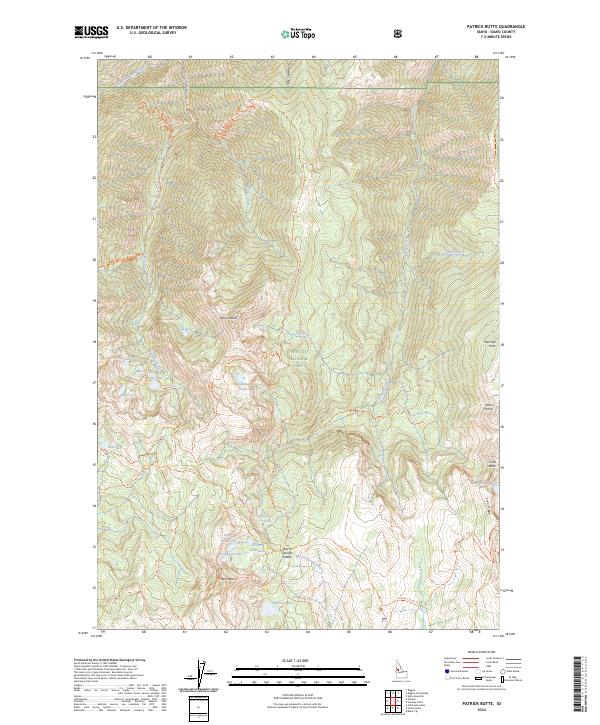
2024 Map of Patrick Butte
USGS Topo · Published 2024About this map
Patrick Butte and Lava Butte dominate this high-elevation landscape within the Payette National Forest. This modern 2024 survey documents a complex network of alpine water bodies and drainage systems, including the cluster of Gay Lake, Mary Lake, John Lake, and Piper Lake in the western reaches. The area is characterized by significant topographic relief, where features like Sams Throne and Hershey Point rise above the surrounding drainages of Patrick Creek and Hell Creek. A established network of wilderness paths, such as the Patrick Butte Trl and Lava Ridge Trl, provides access across the ridgelines and through Box Canyon. To the south, the terrain transitions toward Warm Springs Saddle and the Lower Twin Lake basin, highlighting the hydrographic importance of the Warm Springs Creek headwaters.
Find a feature on this map
49 named features on this map. Tap any name to fly to it.
Don’t see what you’re looking for? This feature index may not catch every label — zoom into the map to look around manually.
Map Details
Editions of this 2024 Patrick Butte Map
This is the sole edition of this map. No revisions or reprints were ever made.
Other maps of this area

1938 · Riggins
USGS Topo · 1:96,000

1945 · Riggins
USGS Topo · 1:125,000

1955 · Grangeville
USGS Topo · 1:250,000

1959 · Grangeville
USGS Topo · 1:250,000

1963 · Indian Mountain
USGS Topo · 1:24,000

1963 · Black Tip
USGS Topo · 1:24,000

1963 · Hershey Point
USGS Topo · 1:24,000
1963 · Hazard Lake
USGS Topo · 1:24,000
1964 · Patrick Butte
USGS Topo · 1:24,000

1964 · Riggins
USGS Topo · 1:24,000