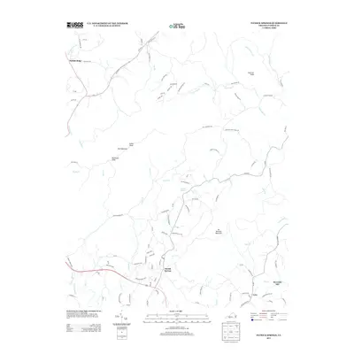
2013 Map of Patrick Springs
USGS Topo · Published 2013About this map
Patrick Springs serves as the central hub of this Patrick County landscape, situated where the terrain transitions toward the prominent heights of Bull Mountain and No Business Mountain. The drainage patterns are defined by the S Mayo River in the southwest and a dense network of creeks including Sycamore Cr, Spoon Cr, and Mill Cr. This 2013 survey illustrates a rural infrastructure built around family-named landmarks and old agricultural routes, such as Tudor Orchard Rd and Pilson Sawmill Rd. To the northeast, Chestnut Knob overlooks the winding course of Polebridge Cr, while the smaller communities of Critz, Buffalo Ridge, and Reynolds Mill are connected by a mix of state routes and descriptive local ways like Fairystone Church Loop. The map reflects a region where the industrial legacy of sawmills and orchards remains imprinted on the modern road network.
Find a feature on this map
102 named features on this map. Tap any name to fly to it.
Don’t see what you’re looking for? This feature index may not catch every label — zoom into the map to look around manually.
Map Details
Editions of this 2013 Patrick Springs Map
This is the sole edition of this map. No revisions or reprints were ever made.
Other maps of this area

1926 · Critz
USGS Topo · 1:48,000

1928 · Stuart
USGS Topo · 1:48,000

1928 · Critz
USGS Topo · 1:62,500

1931 · Stuart
USGS Topo · 1:62,500

1953 · Winston-Salem
USGS Topo · 1:250,000

1955 · Winston-Salem
USGS Topo · 1:250,000

1957 · Endicott
USGS Topo · 1:62,500

1957 · Floyd
USGS Topo · 1:62,500

1962 · Winston-Salem
USGS Topo · 1:250,000

1967 · Patrick Springs
USGS Topo · 1:24,000