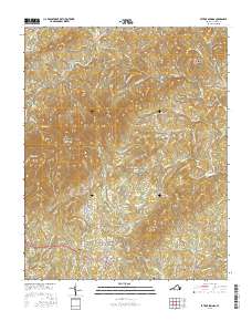
2016 Map of Patrick Springs
USGS Topo · Published 2016About this map
The South Mayo River carves through the southern landscape of this Virginia survey, anchoring a network of small settlements and family landmarks. The community of Patrick Springs serves as a central hub, surrounded by topographic heights such as No Business Mtn and Richwood Knob Bull Mtn. Local history and genealogy are well-represented by several burial sites, including Patrick Springs Cem, Liberty Cem, and the Patrick Memorial Gardens. Toward the eastern edge, the settlement of Critz sits near the headwaters of Spencer Cr, while the historic Reynolds Mill suggests the area's long-standing reliance on local waterpower. The terrain is defined by a series of ridges and knobs, including Buffalo Ridge and Gabes Knob, which have dictated the winding paths of local thoroughfares like Old Mill Rd and Scenic Dr. Small-scale aviation is represented by the presence of Landis Airport near the southern border.
Find a feature on this map
93 named features on this map. Tap any name to fly to it.
Don’t see what you’re looking for? This feature index may not catch every label — zoom into the map to look around manually.
Map Details
Editions of this 2016 Patrick Springs Map
This is the sole edition of this map. No revisions or reprints were ever made.
Other maps of this area

1926 · Critz
USGS Topo · 1:48,000

1928 · Stuart
USGS Topo · 1:48,000

1928 · Critz
USGS Topo · 1:62,500

1931 · Stuart
USGS Topo · 1:62,500

1953 · Winston-Salem
USGS Topo · 1:250,000

1955 · Winston-Salem
USGS Topo · 1:250,000

1957 · Endicott
USGS Topo · 1:62,500

1957 · Floyd
USGS Topo · 1:62,500

1962 · Winston-Salem
USGS Topo · 1:250,000

1967 · Patrick Springs
USGS Topo · 1:24,000