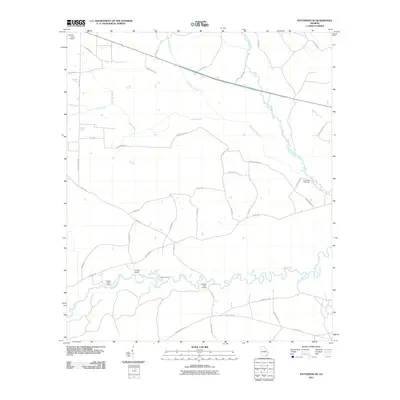
2011 Map of Patterson SE
USGS Topo · Published 2011About this map
The Satilla River winds through this coastal plain landscape, defining the southern geography with its tight oxbows and numerous crossings. Traces of historical river transit are evident at Dowling Ford and Dowlings Ferry Landing, while Indian Bluff rises above the water's edge nearby. To the north, the Little Satilla River and its tributaries, including Sixty Foot Branch and Otter Creek, drain the low-lying terrain characterized by several sections of Cross Swamp Rd.
Find a feature on this map
41 named features on this map. Tap any name to fly to it.
Don’t see what you’re looking for? This feature index may not catch every label — zoom into the map to look around manually.
Map Details
Editions of this 2011 Patterson SE Map
This is the sole edition of this map. No revisions or reprints were ever made.
Other maps of this area

1917 · Nahunta
USGS Topo · 1:62,500

1918 · Hortense
USGS Topo · 1:62,500

1918 · Nahunta
USGS Topo · 1:62,500

1944 · Hortense
USGS Topo · 1:62,500

1946 · Brunswick
USGS Topo · 1:250,000

1948 · Brunswick
USGS Topo · 1:250,000

1953 · Waycross
USGS Topo · 1:250,000

1956 · Brunswick
USGS Topo · 1:250,000

1958 · Waycross
USGS Topo · 1:250,000

1961 · Brunswick
USGS Topo · 1:250,000