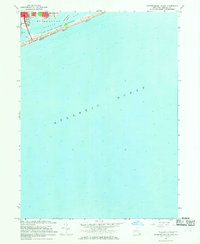
1967 Map of Pattersquash Island
USGS Topo · Published 1969About this map
Pattersquash Island and the coastal reaches of Brookhaven define this 1967 survey of the Long Island shoreline. The map documents the barrier beach environment of the Fire Island National Seashore, specifically Great South Beach and South Beach, accessible via the Smith Point Bridge. On the mainland, the established residential patterns of Shirley and Mastic Beach are clearly visible, bounded by a network of waterways including Unkechogue Creek, Johns Neck Creek, and Sheeppen Creek.
Find a feature on this map
24 named features on this map. Tap any name to fly to it.
Don’t see what you’re looking for? This feature index may not catch every label — zoom into the map to look around manually.
Map Details
Editions of this 1967 Pattersquash Island Map
2 editions found
Other maps of this area

1903 · Riverhead
USGS Topo · 1:62,500

1904 · Riverhead
USGS Topo · 1:62,500

1904 · Moriches
USGS Topo · 1:62,500

1943 · Riverhead
USGS Topo · 1:62,500

1947 · Bellport
USGS Topo · 1:24,000

1947 · Howells Point
USGS Topo · 1:24,000

1947 · Eastport
USGS Topo · 1:24,000

1949 · New York
USGS Topo · 1:250,000

1954 · New York
USGS Topo · 1:250,000
1956 · Howells Point
USGS Topo · 1:24,000