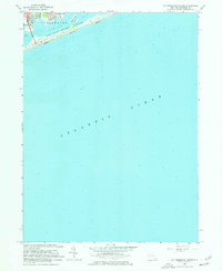
1967 Map of Pattersquash Island
USGS Topo · Published 1977About this map
Pattersquash Island sits at the heart of this coastal study, positioned between the waters of Great South Bay and Narrow Bay. The map documents the mid-century suburban expansion of Shirley and Mastic Beach on the mainland, where residential grids like Rugby Dr and Hickory Rd push toward the shoreline of Johns Neck. A notable infrastructure feature is the Wm Floyd Pkwy, which connects the mainland to the barrier beach via a Toll Bridge near the Tollgate.
Find a feature on this map
23 named features on this map. Tap any name to fly to it.
Don’t see what you’re looking for? This feature index may not catch every label — zoom into the map to look around manually.
Map Details
Editions of this 1967 Pattersquash Island Map
2 editions found
Other maps of this area

1903 · Riverhead
USGS Topo · 1:62,500

1904 · Riverhead
USGS Topo · 1:62,500

1904 · Moriches
USGS Topo · 1:62,500

1943 · Riverhead
USGS Topo · 1:62,500

1947 · Bellport
USGS Topo · 1:24,000

1947 · Howells Point
USGS Topo · 1:24,000

1947 · Eastport
USGS Topo · 1:24,000

1949 · New York
USGS Topo · 1:250,000

1954 · New York
USGS Topo · 1:250,000
1956 · Howells Point
USGS Topo · 1:24,000