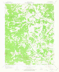
1959 Map of Patton
USGS Topo · Published 1975About this map
The Whitewater River and its tributary, the Little Whitewater River, carve through the Missouri landscape where the Perry Co and Bollinger Co line meets. In the late 1950s, this region remained a network of small upland communities and rural landmarks. The survey documents the cluster of settlements at the southeastern corner, including Patton, North Patton, and Patton Junction, which serve as the primary hubs for the surrounding countryside. Scattered across the hills are institutions of local importance such as the Oak Grove Sch and Bess Sch, alongside spiritual centers like Pine Hill Ch, Bethel Ch, and Reagan Chapel. This map provides a detailed look at the rural Missouri Ozarks just before significant modernization of the road systems, capturing the placement of family cemeteries like Yount Cem and Pleasant Hill Cem that remain vital for genealogical research.
Find a feature on this map
25 named features on this map. Tap any name to fly to it.
Don’t see what you’re looking for? This feature index may not catch every label — zoom into the map to look around manually.
Map Details
Editions of this 1959 Patton Map
2 editions found
Other maps of this area

1910 · Higdon
USGS Topo · 1:62,500

1923 · Perryville
USGS Topo · 1:62,500

1924 · Perryville
USGS Topo · 1:62,500

1933 · Marble Hill
USGS Topo · 1:62,500

1933 · Marquand
USGS Topo · 1:62,500

1937 · Marble Hill
USGS Topo · 1:62,500

1938 · Marquand
USGS Topo · 1:62,500

1949 · Paducah
USGS Topo · 1:250,000

1949 · Rolla
USGS Topo · 1:250,000

1950 · Paducah
USGS Topo · 1:250,000