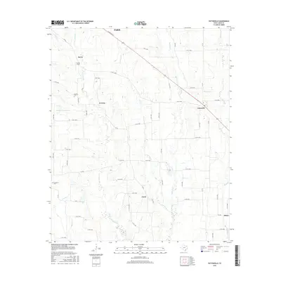
2016 Map of Pattonville
USGS Topo · Published 2016About this map
Pattonville serves as a primary hub in this rural Lamar County landscape, situated at the junction of several farm-to-market roads southeast of Paris. The terrain is defined by a dense network of meandering waterways, including the prominent Big Sandy Cr and Little Sandy Cr, which drain the agricultural land between small unincorporated communities. Small settlements like Marvin, Jennings, and Clardy are connected by a grid of county roads, reflecting a long-standing pattern of dispersed farming homesteads. Local history is anchored by sites such as the Neathery Cem and Biardstown Cem, while Burress Airport and specialized reservoirs like Newman Lake Number 4 indicate modern land use and infrastructure. The area’s hydrology is further complicated by Bee Bayou and Mulberry Cr, illustrating the low-lying nature of the Gulf Coastal Plain in East Texas.
Find a feature on this map
62 named features on this map. Tap any name to fly to it.
Don’t see what you’re looking for? This feature index may not catch every label — zoom into the map to look around manually.
Map Details
Editions of this 2016 Pattonville Map
This is the sole edition of this map. No revisions or reprints were ever made.
Other maps of this area

1903 · Paris
USGS Topo · 1:125,000

1948 · Paris
USGS Topo · 1:62,500

1949 · Paris
USGS Topo · 1:62,500

1953 · Texarkana
USGS Topo · 1:250,000

1956 · Texarkana
USGS Topo · 1:250,000

1963 · Minter
USGS Topo · 1:24,000

1963 · Cunningham
USGS Topo · 1:24,000

1964 · Detroit
USGS Topo · 1:24,000

1964 · Deport
USGS Topo · 1:24,000

1964 · Pattonville
USGS Topo · 1:24,000