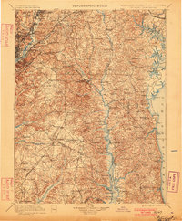
1899 Map of Patuxent
USGS Topo · Published 1901About this map
Upper Marlboro and the river-dependent settlements of southern Maryland are presented here at the close of the 19th century, showing a landscape defined by its complex waterways and emerging rail lines. The Patuxent River serves as a central artery, dotted with historic crossings like Magruder Ferry and commercial hubs such as Lyons Wharf. To the west, the expansion of education and institutional life is visible at the Maryland Agril. College and the Maryland Reform School.
Find a feature on this map
199 named features on this map. Tap any name to fly to it.
Don’t see what you’re looking for? This feature index may not catch every label — zoom into the map to look around manually.
Map Details
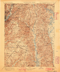
Editions of this 1899 Patuxent Map
3 editions found

Other maps of this area

1889 · Fredericksburg
USGS Topo · 1:125,000

1890 · Mt. Vernon
USGS Topo · 1:125,000

1891 · Mt. Vernon
USGS Topo · 1:125,000

1892 · Leonardtown
USGS Topo · 1:62,500

1892 · Laurel
USGS Topo · 1:62,500

1892 · Fredericksburg
USGS Topo · 1:125,000

1892 · Drum Point
USGS Topo · 1:62,500

1892 · Prince Frederick
USGS Topo · 1:62,500

1892 · Brandywine
USGS Topo · 1:62,500

1892 · Owensville
USGS Topo · 1:62,500