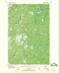
1955 Map of Patzau
USGS Topo · Published 1970About this map
Patzau anchors the northern edge of this mid-century survey of northwestern Wisconsin, a landscape defined by its expansive wetlands and the headwaters of several river systems. The transition of the rural educational landscape is evident in the marking of several closed institutions, including the Amnicon Lake Sch (Abandoned), McCreary Sch (Abandoned), and Chaffey Sch (Abandoned). These former community centers sit amidst a complex network of water and wilderness, where the Amnicon River flows northward and the Upper Tamarack River drains to the south.
Find a feature on this map
41 named features on this map. Tap any name to fly to it.
Don’t see what you’re looking for? This feature index may not catch every label — zoom into the map to look around manually.
Map Details
Editions of this 1955 Patzau Map
3 editions found

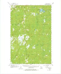
Other maps of this area

1915 · Superior
USGS Topo · 1:48,000

1917 · Superior
USGS Topo · 1:62,500

1945 · Solon Springs
USGS Topo · 1:48,000

1947 · Minong
USGS Topo · 1:48,000

1949 · Danbury
USGS Topo · 1:48,000

1949 · Solon Springs
USGS Topo · 1:48,000

1949 · Holyoke
USGS Topo · 1:48,000

1949 · Minong
USGS Topo · 1:48,000

1949 · Webb Lake
USGS Topo · 1:48,000

1949 · Patzau
USGS Topo · 1:48,000