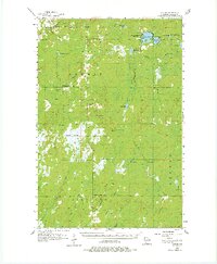
1955 Map of Patzau
USGS Topo · Published 1977About this map
Patzau and Moose Junction anchor this mid-century survey of the headwaters region in southern Douglas County. The landscape is defined by extensive wetlands, notably the Belden Swamp and Empire Swamp, which feed a complex network of waterways including the Amnicon River and Upper Tamarack River. By the 1950s, the local rural infrastructure showed signs of consolidation, with several educational landmarks marked as defunct, such as the Amnicon Lake Sch. and McCreary Sch. near Summit Lake.
Find a feature on this map
37 named features on this map. Tap any name to fly to it.
Don’t see what you’re looking for? This feature index may not catch every label — zoom into the map to look around manually.
Map Details
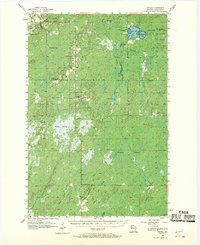
Editions of this 1955 Patzau Map
3 editions found

Other maps of this area

1915 · Superior
USGS Topo · 1:48,000

1917 · Superior
USGS Topo · 1:62,500

1945 · Solon Springs
USGS Topo · 1:48,000

1947 · Minong
USGS Topo · 1:48,000

1949 · Danbury
USGS Topo · 1:48,000

1949 · Solon Springs
USGS Topo · 1:48,000

1949 · Holyoke
USGS Topo · 1:48,000

1949 · Minong
USGS Topo · 1:48,000

1949 · Webb Lake
USGS Topo · 1:48,000

1949 · Patzau
USGS Topo · 1:48,000