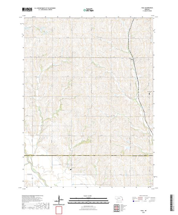
2021 Map of Paul
USGS Topo · Published 2021About this map
Paul stands as the primary settlement in this portion of the Nebraska countryside, situated where the rolling uplands of Otoe County and Nemaha County meet. The landscape is defined by a dendritic drainage pattern where Rock Creek and Sand Creek flow southward toward the Little Nemaha River. This modern survey illustrates a highly managed watershed, featuring a cluster of reservoirs including Wilson Cr Reservoir 1-9, Wilson Cr Reservoir 1-10, and Wilson Cr Reservoir 1-F. These structures, alongside the section-line road grid, reflect the intersection of agricultural utility and soil conservation efforts in the region. For local historians, the map preserves the locations of established burial grounds like Bloomingdale Cem and Lafayette Cem, which serve as quiet markers of the area's rural communities.
Find a feature on this map
33 named features on this map. Tap any name to fly to it.
Don’t see what you’re looking for? This feature index may not catch every label — zoom into the map to look around manually.
Map Details
Editions of this 2021 Paul Map
This is the sole edition of this map. No revisions or reprints were ever made.
Other maps of this area

1903 · Weeping Water
USGS Topo · 1:125,000

1907 · Nebraska City
USGS Topo · 1:62,500

1915 · Howe
USGS Topo · 1:62,500

1929 · Weeping Water
USGS Topo · 1:125,000

1955 · Nebraska City
USGS Topo · 1:250,000

1955 · Lincoln
USGS Topo · 1:250,000

1957 · Nebraska City
USGS Topo · 1:250,000

1957 · Lincoln
USGS Topo · 1:250,000

1958 · Lincoln
USGS Topo · 1:250,000

1958 · Nebraska City
USGS Topo · 1:250,000