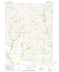
1966 Map of Paul
USGS Topo · Published 1968About this map
Paul sits at a geographic crossroads in Otoe County, where the Missouri Pacific railroad cuts through the landscape near the banks of Rock Creek. This mid-1960s survey reveals a rural society organized around small schoolhouses and country parishes, such as Maple Grove Sch and St Josephs Ch. The terrain transitions from the upland heights of Belmont and Four Mile down to the southwest corner, where the Little Nemaha River enters the frame. The map provides significant detail for genealogists, recording the locations of Bloomingdale Cem and Lafayette Cem. A local Sandpit near Plum Run suggests the modest extractive activity that supported regional infrastructure. The intricate network of fence and field lines, mapped from 1965 aerial photography, offers a precise record of agricultural land division during this era.
Find a feature on this map
24 named features on this map. Tap any name to fly to it.
Don’t see what you’re looking for? This feature index may not catch every label — zoom into the map to look around manually.
Map Details
Editions of this 1966 Paul Map
This is the sole edition of this map. No revisions or reprints were ever made.
Other maps of this area

1903 · Weeping Water
USGS Topo · 1:125,000

1907 · Nebraska City
USGS Topo · 1:62,500

1915 · Howe
USGS Topo · 1:62,500

1929 · Weeping Water
USGS Topo · 1:125,000

1955 · Nebraska City
USGS Topo · 1:250,000

1955 · Lincoln
USGS Topo · 1:250,000

1957 · Nebraska City
USGS Topo · 1:250,000

1957 · Lincoln
USGS Topo · 1:250,000

1958 · Lincoln
USGS Topo · 1:250,000

1958 · Nebraska City
USGS Topo · 1:250,000