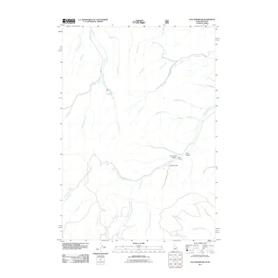
2011 Map of Paul Reservoir
USGS Topo · Published 2011About this map
Paul Reservoir and its namesake Paul Dam center this high-elevation drainage basin in Beaverhead County. The landscape is defined by an intricate network of waterways, including East Modoc Creek and Idaho Creek, which converge as they flow through the southern Bitterroot Range. Evidence of Forest Service land management is visible through specialized routes such as Nat For Dev Rd 3230 and Modoc Rd, which provide access to the remote backcountry. Notable topographical features like Swampy Draw and White Pine Canyon illustrate the complex watershed that feeds into larger systems. This 2011 survey records the hydrologic and transit infrastructure of the region, from the seasonal Lone Pine Spring to the distinct branches of Middle Dry Creek and East Fork Cottonwood Creek.
Find a feature on this map
37 named features on this map. Tap any name to fly to it.
Don’t see what you’re looking for? This feature index may not catch every label — zoom into the map to look around manually.
Map Details
Editions of this 2011 Paul Reservoir Map
This is the sole edition of this map. No revisions or reprints were ever made.
Other maps of this area

1955 · Dubois
USGS Topo · 1:250,000

1957 · Paul Reservoir
USGS Topo · 1:62,500

1958 · Dubois
USGS Topo · 1:250,000

1968 · Corral Creek
USGS Topo · 1:24,000

1968 · Snowline
USGS Topo · 1:24,000

1968 · Monida
USGS Topo · 1:24,000

1972 · Spencer South
USGS Topo · 1:24,000

1972 · Spencer North
USGS Topo · 1:24,000

1983 · Dubois
USGS Topo · 1:100,000
1987 · Thunder Gulch
USGS Topo · 1:24,000