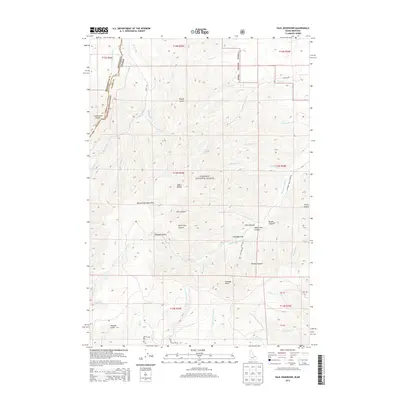
2013 Map of Paul Reservoir
USGS Topo · Published 2013About this map
Paul Reservoir sits high within the Targhee National Forest, marking a landscape where high-altitude hydrology and the crest of the Beaverhead Mountains define the terrain. This 2013 survey follows the high country of the Continental Divide along the border between Montana and Idaho, a region dominated by deep drainages and named basins. The eastern slopes are characterized by a series of significant canyons and hollows, including Kite Canyon, White Pine Canyon, and Brooks Canyon, which feed into Pleasant Valley and Swampy Draw. Local water systems like Modoc Cr and Pleasant Valley Cr illustrate the complex watershed of the Beaverhead range. The presence of features such as Thunder Gulch and Tenpin Gulch suggests a landscape shaped by persistent erosion, while names like Idaho Hollow and Pleasant Valley provide a window into the traditional naming conventions of this high-mountain borderland.
Find a feature on this map
57 named features on this map. Tap any name to fly to it.
Don’t see what you’re looking for? This feature index may not catch every label — zoom into the map to look around manually.
Map Details
Editions of this 2013 Paul Reservoir Map
This is the sole edition of this map. No revisions or reprints were ever made.
Other maps of this area

1955 · Dubois
USGS Topo · 1:250,000

1957 · Paul Reservoir
USGS Topo · 1:62,500

1958 · Dubois
USGS Topo · 1:250,000

1968 · Corral Creek
USGS Topo · 1:24,000

1968 · Snowline
USGS Topo · 1:24,000

1968 · Monida
USGS Topo · 1:24,000

1972 · Spencer South
USGS Topo · 1:24,000

1972 · Spencer North
USGS Topo · 1:24,000

1983 · Dubois
USGS Topo · 1:100,000
1987 · Thunder Gulch
USGS Topo · 1:24,000