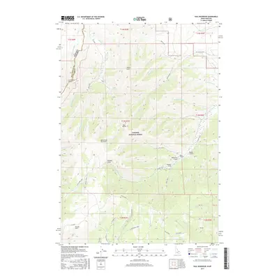
2017 Map of Paul Reservoir
USGS Topo · Published 2017About this map
The Continental Divide serves as the primary geographic anchor for this 2017 survey, defining the high-altitude border between Beaverhead Co and Clark County along the Montana-Idaho state line. This landscape within the Targhee National Forest is characterized by the complex drainage systems of the Beaverhead Mountains, where numerous watercourses like Modoc Creek and Berry Creek flow through deep-cut features such as Tenpin Gulch and Kite Canyon. The map reveals a remote pastoral and transit character, evidenced by the expansive Pleasant Valley and the winding path of Skyline Road crossing the southern portion. For researchers, the presence of specific landmarks like Lone Pine Spring and named meadows like Idaho Hollow provide localized points of reference in an area defined more by its physical topography and forest boundaries than by permanent settlements.
Find a feature on this map
65 named features on this map. Tap any name to fly to it.
Don’t see what you’re looking for? This feature index may not catch every label — zoom into the map to look around manually.
Map Details
Editions of this 2017 Paul Reservoir Map
This is the sole edition of this map. No revisions or reprints were ever made.
Other maps of this area

1955 · Dubois
USGS Topo · 1:250,000

1957 · Paul Reservoir
USGS Topo · 1:62,500

1958 · Dubois
USGS Topo · 1:250,000

1968 · Corral Creek
USGS Topo · 1:24,000

1968 · Snowline
USGS Topo · 1:24,000

1968 · Monida
USGS Topo · 1:24,000

1972 · Spencer South
USGS Topo · 1:24,000

1972 · Spencer North
USGS Topo · 1:24,000

1983 · Dubois
USGS Topo · 1:100,000
1987 · Thunder Gulch
USGS Topo · 1:24,000