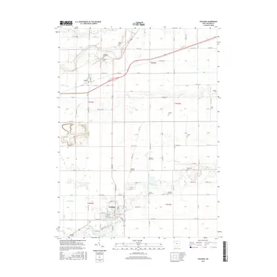
2016 Map of Paulding
USGS Topo · Published 2016About this map
Paulding serves as the focal point of this Northwest Ohio landscape, where the street grid of the county seat meets a complex network of rural township roads and drainage runs. The northern reaches are defined by the winding course of the Maumee River and the Sixmile Cutoff, near the small settlements of Cecil and Emmett. Genealogists will find a high density of burial sites across the township, including the central Live Oak Cem and Paulding Memorial Cem, alongside more remote locations like Rochester Cem and the Ankney Cem. The transition from the riverbanks to the flat agricultural plains is marked by numerous watercourses such as Flatrock Cr and Little Flatrock Cr, which historically dictated the pattern of local transport and land use. Local infrastructure is further evidenced by Paulding Airport Inc and the County Home Cem, reflecting the civic and industrial development of the region in the mid-2010s.
Find a feature on this map
113 named features on this map. Tap any name to fly to it.
Don’t see what you’re looking for? This feature index may not catch every label — zoom into the map to look around manually.
Map Details
Editions of this 2016 Paulding Map
This is the sole edition of this map. No revisions or reprints were ever made.
Other maps of this area

1907 · Defiance
USGS Topo · 1:62,500

1909 · Defiance
USGS Topo · 1:62,500

1909 · Continental
USGS Topo · 1:62,500

1914 · Bryan
USGS Topo · 1:62,500

1914 · Paulding
USGS Topo · 1:62,500

1943 · Bryan
USGS Topo · 1:62,500

1944 · Paulding
USGS Topo · 1:62,500

1953 · Fort Wayne
USGS Topo · 1:250,000

1956 · Fort Wayne
USGS Topo · 1:250,000

1960 · Sherwood
USGS Topo · 1:24,000