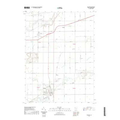
2019 Map of Paulding
USGS Topo · Published 2019About this map
Paulding serves as the central hub of this Northwest Ohio landscape, defined by its historic civic square featuring the Paulding County Courthouse and the Paulding County Courthouse Annex. The town plan is oriented around a grid that meets the diagonal path of the local waterways, where Opossum Run and Flatrock Creek converge south of the main settlement. Further north, the Maumee River cuts across the corner of the map near Cecil, a small community situated at the intersection of several county roads. The region is notable for its dense concentration of burial sites, ranging from the large Live Oak Cem at the edge of the county seat to smaller, outlying plots like Upthegrove Cem and Ankney Cem. This distribution reflects a long-established agricultural settlement pattern where family and community cemeteries were placed throughout the townships of t3n r2e and t3n r3e. In the southwest, the Buehler Airport provides a modern contrast to the surrounding network of township and county roads.
Find a feature on this map
92 named features on this map. Tap any name to fly to it.
Don’t see what you’re looking for? This feature index may not catch every label — zoom into the map to look around manually.
Map Details
Editions of this 2019 Paulding Map
This is the sole edition of this map. No revisions or reprints were ever made.
Other maps of this area

1907 · Defiance
USGS Topo · 1:62,500

1909 · Defiance
USGS Topo · 1:62,500

1909 · Continental
USGS Topo · 1:62,500

1914 · Bryan
USGS Topo · 1:62,500

1914 · Paulding
USGS Topo · 1:62,500

1943 · Bryan
USGS Topo · 1:62,500

1944 · Paulding
USGS Topo · 1:62,500

1953 · Fort Wayne
USGS Topo · 1:250,000

1956 · Fort Wayne
USGS Topo · 1:250,000

1960 · Sherwood
USGS Topo · 1:24,000