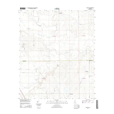
2015 Map of Paulette
USGS Topo · Published 2015About this map
The Noxubee River meanders across this rural landscape on the border of Noxubee and Kemper Counties, defining a region where small hamlets and family burial grounds are connected by a network of country roads. Small settlements such as Paulette, Binnsville, and Calyx are situated amidst a dense web of waterways including Shuqualak Cr and Wahalak Cr. For genealogists, the map is particularly valuable for its documentation of local cemeteries, including Woodlawn Cem, Eaves Cem, and the Old Wahalak Cem. The southern portion of the sheet features the community of Millington and traces of the drainage basin for Pushacoona Cr. The terrain is characterized by the complex hydrology of these creek systems as they feed into the Noxubee, creating a distinctive pattern of land use that has persisted into the 21st century.
Find a feature on this map
34 named features on this map. Tap any name to fly to it.
Don’t see what you’re looking for? This feature index may not catch every label — zoom into the map to look around manually.
Map Details
Editions of this 2015 Paulette Map
This is the sole edition of this map. No revisions or reprints were ever made.
Other maps of this area

1953 · Meridian
USGS Topo · 1:250,000

1953 · West Point
USGS Topo · 1:250,000

1957 · Meridian
USGS Topo · 1:250,000

1958 · West Point
USGS Topo · 1:250,000

1962 · Shuqualak
USGS Topo · 1:24,000

1963 · West Point
USGS Topo · 1:250,000

1963 · Townsend
USGS Topo · 1:24,000

1965 · Meridian
USGS Topo · 1:250,000

1973 · Panola
USGS Topo · 1:24,000

1973 · Scooba
USGS Topo · 1:24,000