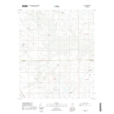
2018 Map of Paulette
USGS Topo · Published 2018About this map
Paulette and the surrounding rural communities of Noxubee Co and Kemper Co are defined by a complex network of waterways feeding the Noxubee River. This landscape is marked by the distinct transition between the low-lying wetlands along Shuqualak Cr and the more elevated terrain containing historic family and community landmarks. Genealogists will find significant value in the distribution of burial grounds, including the Old Wahalak Cem and Binnsville Cem, which suggest the locations of earlier crossroads and settlements. The area's development is closely tied to its hydrography, with Wahalak Cr and Pushacoona Cr carving through the countryside near small centers like Calyx and Millington. Rural transit is represented by local corridors such as Binnsville Rd and Paulette Rd, which connect these dispersed settlements across the county line.
Find a feature on this map
34 named features on this map. Tap any name to fly to it.
Don’t see what you’re looking for? This feature index may not catch every label — zoom into the map to look around manually.
Map Details
Editions of this 2018 Paulette Map
This is the sole edition of this map. No revisions or reprints were ever made.
Other maps of this area

1953 · Meridian
USGS Topo · 1:250,000

1953 · West Point
USGS Topo · 1:250,000

1957 · Meridian
USGS Topo · 1:250,000

1958 · West Point
USGS Topo · 1:250,000

1962 · Shuqualak
USGS Topo · 1:24,000

1963 · West Point
USGS Topo · 1:250,000

1963 · Townsend
USGS Topo · 1:24,000

1965 · Meridian
USGS Topo · 1:250,000

1973 · Panola
USGS Topo · 1:24,000

1973 · Scooba
USGS Topo · 1:24,000