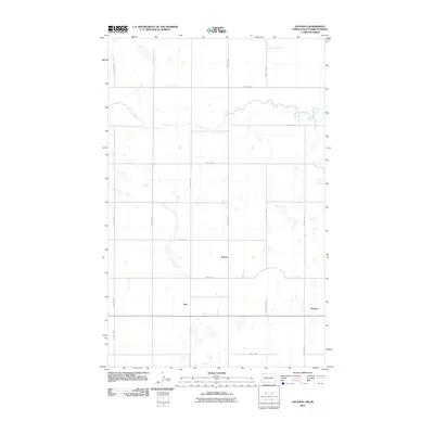
2011 Map of Paulson
USGS Topo · Published 2011About this map
Bounty and Juno anchor this prairie landscape in the northwestern corner of North Dakota, where the grid of the Public Land Survey System defines the human footprint. This 2011 survey illustrates a sparse settlement pattern characteristic of the High Plains, where small named locations like Paulson serve as historical markers for once-bustling rural hubs. The terrain is defined by numerous small, seasonal water bodies and depressions, indicating a pothole-rich topography common in this region. A network of secondary roads, including 118th Ave NW and 101st St Nw, provides the essential infrastructure for the agricultural operations that dominate the area. The map reveals the precise intersection of section lines and the natural drainage patterns that have shaped the land's utility for over a century.
Find a feature on this map
15 named features on this map. Tap any name to fly to it.
Don’t see what you’re looking for? This feature index may not catch every label — zoom into the map to look around manually.
Map Details
Editions of this 2011 Paulson Map
This is the sole edition of this map. No revisions or reprints were ever made.
Other maps of this area

1947 · Noonan
USGS Topo · 1:24,000

1948 · Crosby
USGS Topo · 1:24,000

1948 · Crosby SE
USGS Topo · 1:24,000

1949 · Paulson
USGS Topo · 1:24,000

1949 · Noonan SW
USGS Topo · 1:24,000

1949 · Noonan SE
USGS Topo · 1:24,000

1949 · Noonan
USGS Topo · 1:24,000

1950 · Crosby
USGS Topo · 1:62,500

1950 · Noonan
USGS Topo · 1:62,500

1953 · Williston
USGS Topo · 1:250,000