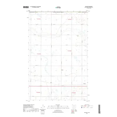
2017 Map of Paulson
USGS Topo · Published 2017About this map
Paulson and the surrounding Divide County prairie sit at the northern edge of North Dakota, where the agricultural grid meets the international border with the United States of America. This high-plains landscape is defined by its rectilinear road network, including 102nd St NW and 114th Ave NW, which connects small rural points such as Bounty and Juno. The topography is punctuated by numerous small wetlands and drainage features that weave between the section lines, highlighting the drainage patterns of the northern Great Plains. A significant historical marker is the Long Creek Cem, providing a focal point for genealogical research in this sparsely populated region. The map illustrates the late 20th and early 21st-century rural infrastructure, documenting the persistence of these remote settlements and their connection to the wider region via well-defined section-line roads.
Find a feature on this map
26 named features on this map. Tap any name to fly to it.
Don’t see what you’re looking for? This feature index may not catch every label — zoom into the map to look around manually.
Map Details
Editions of this 2017 Paulson Map
This is the sole edition of this map. No revisions or reprints were ever made.
Other maps of this area

1947 · Noonan
USGS Topo · 1:24,000

1948 · Crosby
USGS Topo · 1:24,000

1948 · Crosby SE
USGS Topo · 1:24,000

1949 · Paulson
USGS Topo · 1:24,000

1949 · Noonan SW
USGS Topo · 1:24,000

1949 · Noonan SE
USGS Topo · 1:24,000

1949 · Noonan
USGS Topo · 1:24,000

1950 · Crosby
USGS Topo · 1:62,500

1950 · Noonan
USGS Topo · 1:62,500

1953 · Williston
USGS Topo · 1:250,000