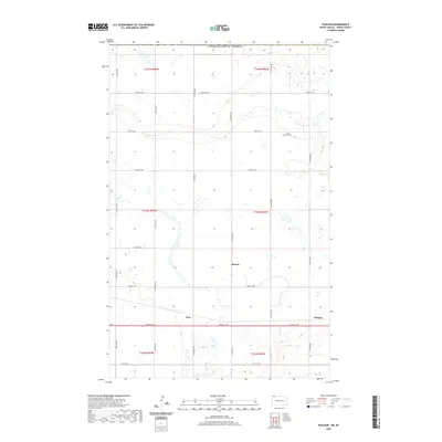
2020 Map of Paulson
USGS Topo · Published 2020About this map
Bounty, Juno, and Paulson sit along the section-line grid of Divide County, just south of the border with the United States of America and Canada. This landscape is defined by the rigid rectangular survey system, where North Dakota state highway Nd 5 and local roads like 102nd St Nw provide the primary east-west corridors. Small clusters of local history are preserved in names like Long Creek Cem, located in the northeast, while the rest of the terrain is marked by a network of ephemeral wetlands and seasonal basins. The map illustrates a contemporary rural environment where widely spaced settlements are connected by a precise grid of numerical routes such as 117th Ave NW and 113th Ave NW, reflecting the enduring structure of the Great Plains homesteading era into the early twenty-first century.
Find a feature on this map
26 named features on this map. Tap any name to fly to it.
Don’t see what you’re looking for? This feature index may not catch every label — zoom into the map to look around manually.
Map Details
Editions of this 2020 Paulson Map
This is the sole edition of this map. No revisions or reprints were ever made.
Other maps of this area

1947 · Noonan
USGS Topo · 1:24,000

1948 · Crosby
USGS Topo · 1:24,000

1948 · Crosby SE
USGS Topo · 1:24,000

1949 · Paulson
USGS Topo · 1:24,000

1949 · Noonan SW
USGS Topo · 1:24,000

1949 · Noonan SE
USGS Topo · 1:24,000

1949 · Noonan
USGS Topo · 1:24,000

1950 · Crosby
USGS Topo · 1:62,500

1950 · Noonan
USGS Topo · 1:62,500

1953 · Williston
USGS Topo · 1:250,000