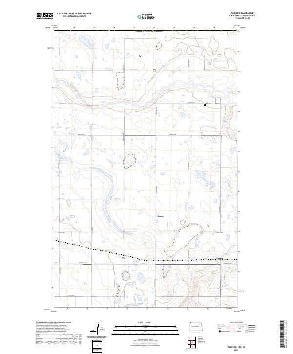
2024 Map of Paulson
USGS Topo · Published 2024About this map
The prairie landscape of United States of America's northern border is defined by a rigorous grid of section lines and isolated settlements in this Divide County region. Paulson and Juno sit along the east-west corridor of Nd 5, serving as local nodes in an expansive agricultural network. Further north, the settlement of Bounty is surrounded by the numerous small wetlands and potholes characteristic of the glaciated plains. This area is heavily organized by the Public Land Survey System, reflected in the township boundaries of t163n r96w and t164n r96w. For those tracing local heritage, the Long Creek Cem provides a specific point of historical continuity amidst the broad stretches of 107th St NW and 112th Ave NW.
Find a feature on this map
25 named features on this map. Tap any name to fly to it.
Don’t see what you’re looking for? This feature index may not catch every label — zoom into the map to look around manually.
Map Details
Editions of this 2024 Paulson Map
This is the sole edition of this map. No revisions or reprints were ever made.
Other maps of this area

1947 · Noonan
USGS Topo · 1:24,000

1948 · Crosby
USGS Topo · 1:24,000

1948 · Crosby SE
USGS Topo · 1:24,000

1949 · Paulson
USGS Topo · 1:24,000

1949 · Noonan SW
USGS Topo · 1:24,000

1949 · Noonan SE
USGS Topo · 1:24,000

1949 · Noonan
USGS Topo · 1:24,000

1950 · Crosby
USGS Topo · 1:62,500

1950 · Noonan
USGS Topo · 1:62,500

1953 · Williston
USGS Topo · 1:250,000