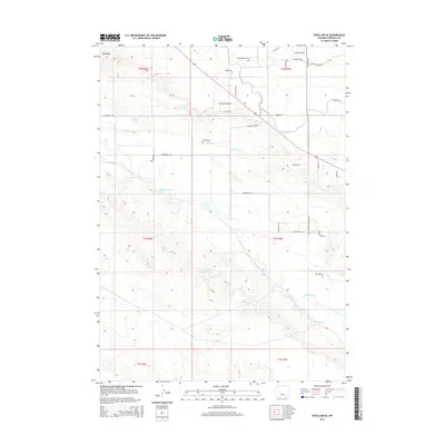
2015 Map of Pavillion SE
USGS Topo · Published 2015About this map
The Wind River meanders across this part of Fremont County, Wyoming, dictating the development of irrigation systems throughout the high desert landscape. The intricate network of the Le clair Canal and the Pilot Canal highlights the region's reliance on water management to support local ranching and agricultural life. Evidence of early land division and homesteading is visible in the placement of the Collins Cem and various family-named routes such as Heil Ranch Rd and Triangle Ranch Rd. The terrain is defined by prominent elevations like Big Ridge, while newer residential developments are signaled by names like Mountain Splendor Dr and Saddle Ridge Ln. The presence of the Lefthand Ditch further emphasizes the enduring engineering efforts required to divert river water across the arid basins of the Wind River Indian Reservation area.
Find a feature on this map
36 named features on this map. Tap any name to fly to it.
Don’t see what you’re looking for? This feature index may not catch every label — zoom into the map to look around manually.
Map Details
Editions of this 2015 Pavillion SE Map
This is the sole edition of this map. No revisions or reprints were ever made.
Other maps of this area

1950 · Pavillion
USGS Topo · 1:24,000

1950 · Ocean Lake
USGS Topo · 1:24,000

1951 · Mule Butte
USGS Topo · 1:24,000

1951 · Pavillion SE
USGS Topo · 1:24,000

1951 · Riverton West
USGS Topo · 1:24,000

1952 · Lost Wells Butte
USGS Topo · 1:24,000

1952 · Hudson
USGS Topo · 1:24,000

1952 · Lander NW
USGS Topo · 1:24,000

1953 · Arapahoe
USGS Topo · 1:24,000

1955 · Thermopolis
USGS Topo · 1:250,000