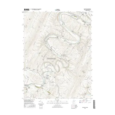
2016 Map of Paw Paw
USGS Topo · Published 2016About this map
The Potomac River winds in deep, dramatic loops through the ridge-and-valley landscape of the Maryland and West Virginia border. This terrain necessitated the engineering marvels of the Chesapeake and Ohio Canal National Historical Park, where the C&O Canal Towpath follows the water's edge. Notable subterranean features like the Paw Paw Tunnel, Stickpile Tunnel, and Graham Tunnel illustrate the massive effort required to navigate the mountain bends. Settled areas like Paw Paw and Magnolia serve as anchors along the river, while smaller points like Hansrote and Keifers mark the historical rail and canal corridor. Numerous family and community burial sites, such as Sulphur Springs Cem, Bevans Cem, and Cherry Orchard Cem, are scattered across the ridges, providing valuable locations for genealogical research in this corridor between the Cacapon River and the Potomac.
Find a feature on this map
165 named features on this map. Tap any name to fly to it.
Don’t see what you’re looking for? This feature index may not catch every label — zoom into the map to look around manually.
Map Details
Editions of this 2016 Paw Paw Map
This is the sole edition of this map. No revisions or reprints were ever made.
Other maps of this area

1891 · Romney
USGS Topo · 1:125,000

1894 · Winchester
USGS Topo · 1:125,000

1898 · Paw Paw
USGS Topo · 1:62,500

1899 · Flintstone
USGS Topo · 1:62,500

1900 · Pawpaw
USGS Topo · 1:62,500

1900 · Flintstone
USGS Topo · 1:62,500

1910 · Paw Paw
USGS Topo · 1:62,500

1916 · Capon Bridge
USGS Topo · 1:62,500

1921 · Hanging Rock
USGS Topo · 1:48,000

1923 · Capon Bridge
USGS Topo · 1:62,500