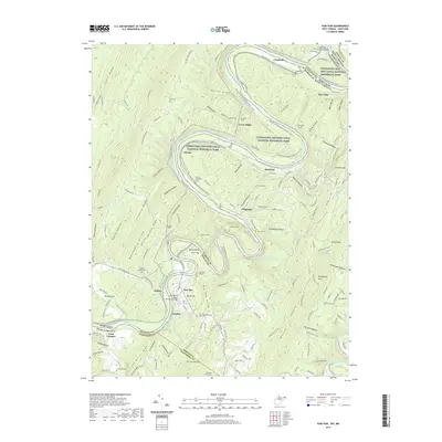
2019 Map of Paw Paw
USGS Topo · Published 2019About this map
The Potomac River carves a dramatic series of loops through the Appalachians, defining the border between West Virginia and Maryland. This 2019 survey of the area near Paw Paw reveals the intricate engineering required to navigate this landscape, prominently featuring the Chesapeake and Ohio Canal National Historical Park. Along the C & O Canal Tow Path, the famous Paw Paw Tunnel stands out as a testament to nineteenth-century ambition, bypassing the river's winding bends.
Find a feature on this map
163 named features on this map. Tap any name to fly to it.
Don’t see what you’re looking for? This feature index may not catch every label — zoom into the map to look around manually.
Map Details
Editions of this 2019 Paw Paw Map
This is the sole edition of this map. No revisions or reprints were ever made.
Other maps of this area

1891 · Romney
USGS Topo · 1:125,000

1894 · Winchester
USGS Topo · 1:125,000

1898 · Paw Paw
USGS Topo · 1:62,500

1899 · Flintstone
USGS Topo · 1:62,500

1900 · Pawpaw
USGS Topo · 1:62,500

1900 · Flintstone
USGS Topo · 1:62,500

1910 · Paw Paw
USGS Topo · 1:62,500

1916 · Capon Bridge
USGS Topo · 1:62,500

1921 · Hanging Rock
USGS Topo · 1:48,000

1923 · Capon Bridge
USGS Topo · 1:62,500