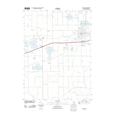
2011 Map of Paw Paw
USGS Topo · Published 2011About this map
Maple Lake serves as a central focal point for the village of Paw Paw, where the East Branch Paw Paw River and South Branch Paw Paw River converge. This 2011 survey reveals a landscape deeply connected to its water resources, with numerous smaller bodies such as Lake Cora, Threemile Lake, and Popendick Lake dotting the township. For the local historian, the map preserves the location of several significant burial grounds, including the historic Pioneer Cemetery near the riverbanks and Saint Marys Cemetery further south. The map documents the residential patterns around Maple Island and the smaller settlement of Wildeys. Landforms like Prospect Hill and the interestingly named Teapot Dome break the surrounding agricultural and marshy terrain, while features like the Paw Paw Post Office and a local power plant mark the community's modern infrastructure.
Find a feature on this map
95 named features on this map. Tap any name to fly to it.
Don’t see what you’re looking for? This feature index may not catch every label — zoom into the map to look around manually.
Map Details
Editions of this 2011 Paw Paw Map
This is the sole edition of this map. No revisions or reprints were ever made.
Other maps of this area

1927 · Hartford
USGS Topo · 1:62,500

1927 · Bangor
USGS Topo · 1:62,500

1931 · Bangor
USGS Topo · 1:62,500

1931 · Hartford
USGS Topo · 1:62,500

1943 · Bangor
USGS Topo · 1:62,500

1944 · Marcellus
USGS Topo · 1:62,500

1946 · Marcellus
USGS Topo · 1:62,500

1946 · Gobles
USGS Topo · 1:62,500

1948 · Gobles
USGS Topo · 1:62,500

1949 · Gobles
USGS Topo · 1:62,500