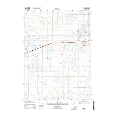
2017 Map of Paw Paw
USGS Topo · Published 2017About this map
The village of Paw Paw serves as the focal point of this southwestern Michigan landscape, situated where the S Br Paw Paw River feeds into Maple Lake. The area's glacial geography is defined by a dense cluster of water bodies including Brownwood Lake, Threemile Lake, and Eagle Lake, interspersed with distinctive rises like Prospect Hill and the curiously named Teapot Dome. This 2017 survey details the complex network of agricultural roads and drains, such as the Gates Extension Drain and Lawton Drain, that support the region's rural economy. Genealogists will find significant value in the distribution of family and local burial grounds scattered across the township, from the centrally located Pioneer Cem and Saint Marys Cem near the village to more isolated sites like Wildey Cem and Threemile Cem.
Find a feature on this map
77 named features on this map. Tap any name to fly to it.
Don’t see what you’re looking for? This feature index may not catch every label — zoom into the map to look around manually.
Map Details
Editions of this 2017 Paw Paw Map
This is the sole edition of this map. No revisions or reprints were ever made.
Other maps of this area

1927 · Hartford
USGS Topo · 1:62,500

1927 · Bangor
USGS Topo · 1:62,500

1931 · Bangor
USGS Topo · 1:62,500

1931 · Hartford
USGS Topo · 1:62,500

1943 · Bangor
USGS Topo · 1:62,500

1944 · Marcellus
USGS Topo · 1:62,500

1946 · Marcellus
USGS Topo · 1:62,500

1946 · Gobles
USGS Topo · 1:62,500

1948 · Gobles
USGS Topo · 1:62,500

1949 · Gobles
USGS Topo · 1:62,500