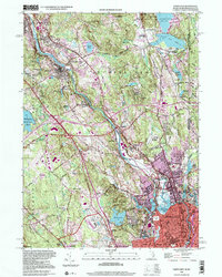
1998 Map of Pawtucket
USGS Topo · Published 2000About this map
The Blackstone River carves through this northern Rhode Island industrial corridor, defining a landscape shaped by mill-driven development and textile history. While urban density concentrates in Central Falls and the surrounding villages of Valley Falls and Lonsdale, the map reveals a surprisingly diverse terrain ranging from the dense granite outcrops of Lincoln Woods State Park to the higher elevations of Beacon Pole Hill and Diamond Hill.
Find a feature on this map
74 named features on this map. Tap any name to fly to it.
Don’t see what you’re looking for? This feature index may not catch every label — zoom into the map to look around manually.
Map Details
Editions of this 1998 Pawtucket Map
This is the sole edition of this map. No revisions or reprints were ever made.
Other maps of this area

1886 · Blackstone
USGS Topo · 1:62,500

1887 · Franklin
USGS Topo · 1:62,500

1887 · Providence
USGS Topo · 1:62,500

1889 · Providence
USGS Topo · 1:62,500

1889 · Blackstone
USGS Topo · 1:62,500

1889 · Franklin
USGS Topo · 1:62,500

1889 · Burrillville
USGS Topo · 1:62,500

1893 · Franklin
USGS Topo · 1:62,500

1893 · Blackstone
USGS Topo · 1:62,500

1894 · Burrillville
USGS Topo · 1:62,500