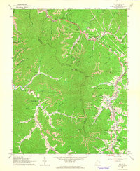
1965 Map of Pax
USGS Topo · Published 1966About this map
The industrial coal and rail landscape of the mid-1960s is on full display here, where the border of Kanawha Co, Fayette Co, and Raleigh Co meet. The settlement of Pax serves as a central hub, where the Norfolk and Western and C & O rail lines intersect with the Turnpike. The terrain is characterized by intensive resource extraction, visible through numerous labels for strip mines, a Tipple, and mine dumps clustered near communities like Milburn and Kingston.
Find a feature on this map
96 named features on this map. Tap any name to fly to it.
Don’t see what you’re looking for? This feature index may not catch every label — zoom into the map to look around manually.
Map Details
Editions of this 1965 Pax Map
3 editions found
Other maps of this area

1891 · Raleigh
USGS Topo · 1:125,000

1897 · Kanawha Falls
USGS Topo · 1:125,000

1897 · Raleigh
USGS Topo · 1:125,000

1900 · Kanawha Falls
USGS Topo · 1:125,000

1901 · Kanawha Falls
USGS Topo · 1:125,000

1902 · Raleigh
USGS Topo · 1:125,000

1908 · Fayetteville
USGS Topo · 1:48,000

1908 · Montgomery
USGS Topo · 1:48,000

1910 · Fayetteville
USGS Topo · 1:62,500

1910 · Montgomery
USGS Topo · 1:62,500