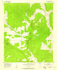
1952 Map of Paxton Springs
USGS Topo · Published 1958About this map
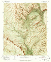
Paxton Springs sits at the heart of this mid-century survey, a focal point within the Cibola National Forest. The landscape is defined by the high elevations of the Zuni Mountains, where the Continental Divide traverses the southern half of the quadrangle. This area shows a mix of volcanic activity and high-desert drainage, evidenced by multiple Cinder Pits and several prominent lava flows that spill through the canyons.
Find a feature on this map
21 named features on this map. Tap any name to fly to it.
Don’t see what you’re looking for? This feature index may not catch every label — zoom into the map to look around manually.
Map Details
Editions of this 1952 Paxton Springs Map
8 editions found

Other maps of this area

1883 · Mt. Taylor
USGS Topo · 1:250,000

1886 · Wingate
USGS Topo · 1:250,000

1886 · Mt. Taylor
USGS Topo · 1:250,000

1892 · Wingate
USGS Topo · 1:250,000

1892 · Mt. Taylor
USGS Topo · 1:250,000

1899 · Mt. Taylor
USGS Topo · 1:250,000

1917 · Broom Mountain
USGS Topo · 1:125,000

1951 · Mt Sedgwick
USGS Topo · 1:24,000

1952 · Valle Largo
USGS Topo · 1:24,000

1952 · Post Office Flat
USGS Topo · 1:24,000