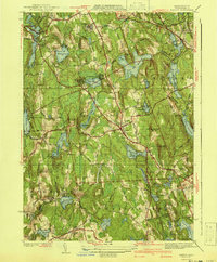
1941 Map of Paxton
USGS Topo · Published 1941About this map
Paxton and its neighboring townships in Worcester County appear here as a landscape defined by its vital water infrastructure and early 20th-century institutional grounds. The map detail highlights a series of reservoirs, including Reservoir No 4 and Asnebumskit Pond, which served the region's growing population centers. Institutional history is prominent at Rutland Heights, where the State Sanitorium and a large Veterans Hospital occupy the high ground near Barrack Hill. Local industrial roots are visible in the names of Upper Wire Village and Lower Wire Village in the south, while the Boston and Albany RR (Abandoned) line traces the evolution of transportation through Rutland. Families can trace ancestral lands through localized landmarks like Tafts Corner and the quiet Quaker Cem, capturing the character of these Central Massachusetts communities just before the mid-century.
Find a feature on this map
67 named features on this map. Tap any name to fly to it.
Don’t see what you’re looking for? This feature index may not catch every label — zoom into the map to look around manually.
Map Details
Editions of this 1941 Paxton Map
3 editions found
Other maps of this area

1885 · Worcester
USGS Topo · 1:62,500

1886 · Worcester
USGS Topo · 1:62,500

1887 · Brookfield
USGS Topo · 1:62,500

1887 · Barre
USGS Topo · 1:62,500

1889 · Webster
USGS Topo · 1:62,500

1889 · Barre
USGS Topo · 1:62,500

1890 · Brookfield
USGS Topo · 1:62,500

1892 · Webster
USGS Topo · 1:62,500

1892 · Worcester
USGS Topo · 1:62,500

1893 · Brookfield
USGS Topo · 1:62,500