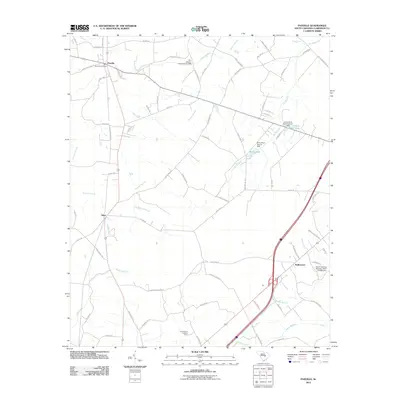
2011 Map of Paxville
USGS Topo · Published 2011About this map
Paxville anchors the northwestern corner of this Clarendon County landscape, where the Paxville Post Office sits at a critical junction of local transport routes like Curtis Millpond Rd. The terrain is defined by an intricate network of waterways, most notably the meandering Sammy Swamp and Jacks Creek, which dictate the placement of rural settlements such as Silver and Halleytown. The drainage pattern is complex, with named tributaries like Wildcat Branch, Knife Branch, and Rosehen Branch feeding the larger swamp systems.
Find a feature on this map
74 named features on this map. Tap any name to fly to it.
Don’t see what you’re looking for? This feature index may not catch every label — zoom into the map to look around manually.
Map Details
Editions of this 2011 Paxville Map
This is the sole edition of this map. No revisions or reprints were ever made.
Other maps of this area

1920 · Mayesville
USGS Topo · 1:48,000

1920 · Manning
USGS Topo · 1:48,000

1921 · Manning
USGS Topo · 1:62,500

1921 · Mayesville
USGS Topo · 1:62,500

1943 · Mayesville
USGS Topo · 1:62,500

1944 · Manning
USGS Topo · 1:62,500

1946 · Sumter
USGS Topo · 1:62,500

1954 · Augusta
USGS Topo · 1:250,000

1957 · Sumter
USGS Topo · 1:62,500

1957 · Augusta
USGS Topo · 1:250,000