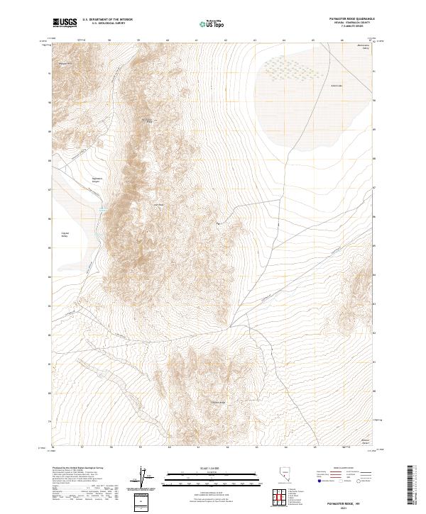
2021 Map of Paymaster Ridge
USGS Topo · Published 2021About this map
Pearl Hot Springs and Twin Springs mark a rare hydrologic presence in this arid portion of Esmeralda County, situated between the Weepah Hills and the floor of Clayton Valley. The landscape is dominated by the north-south alignment of Paymaster Ridge and Clayton Ridge, which channel drainage through Paymaster Canyon toward the lower desert basins. The presence of Alkali Lake in the northeast corner, within the Montezuma Valley, suggests a seasonal catchment area typical of the Great Basin's internal drainage systems. Remote access is provided by several named routes including Silver Peak Rd and Paymaster Canyon Rd, which navigate the elevation changes around Joes Peak. This terrain reflects the stark transition from high ridge lines to the edge of the Ralston Desert.
Find a feature on this map
20 named features on this map. Tap any name to fly to it.
Don’t see what you’re looking for? This feature index may not catch every label — zoom into the map to look around manually.
Map Details
Editions of this 2021 Paymaster Ridge Map
This is the sole edition of this map. No revisions or reprints were ever made.
Other maps of this area

1898 · Silver Peak
USGS Topo · 1:125,000

1900 · Silver Peak
USGS Topo · 1:125,000

1908 · Lida
USGS Topo · 1:250,000

1913 · Lida
USGS Topo · 1:250,000

1945 · Goldfield
USGS Topo · 1:125,000

1954 · Goldfield
USGS Topo · 1:250,000

1955 · Goldfield
USGS Topo · 1:250,000

1958 · Goldfield
USGS Topo · 1:250,000

1962 · Goldfield
USGS Topo · 1:250,000

1963 · Silver Peak
USGS Topo · 1:62,500