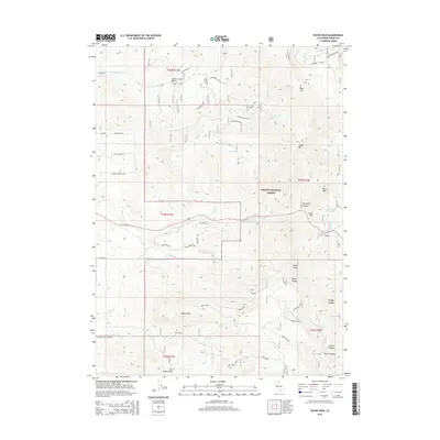
2015 Map of Payne Peak
USGS Topo · Published 2015About this map
Payne Peak dominates the southern reaches of this mountain landscape in Modoc County, marking a high point in a region defined by complex canyon systems and seasonal watercourses. The area is part of the Modoc National Forest, where the terrain drops into significant basins such as the Joseph Creek Basin and the Dry Creek Basin. Drainages like Bolan Cr and Cantrall Cr carve through the slopes, while the presence of Slough Reservoir near Cedar Pass indicates historical water management for the surrounding ranchlands or forest service needs. The map reveals a network of mountain roads including Warner Mountain Dr and Old Coyote Ct, providing access to high-elevation points like Bald Mtn and Bear Mtn. This data shows the intersection of natural landmarks like Sheep Rock with modern forest management routes like the Deep Skyline.
Find a feature on this map
52 named features on this map. Tap any name to fly to it.
Don’t see what you’re looking for? This feature index may not catch every label — zoom into the map to look around manually.
Map Details
Editions of this 2015 Payne Peak Map
This is the sole edition of this map. No revisions or reprints were ever made.
Other maps of this area

1886 · Alturas
USGS Topo · 1:250,000

1892 · Alturas
USGS Topo · 1:250,000

1954 · Alturas
USGS Topo · 1:250,000

1958 · Alturas
USGS Topo · 1:250,000

1962 · Alturas
USGS Topo · 1:250,000

1962 · Davis Creek
USGS Topo · 1:62,500

1962 · Cedarville
USGS Topo · 1:62,500

1963 · Warren Peak
USGS Topo · 1:24,000

1963 · Shields Creek
USGS Topo · 1:24,000

1963 · Dorris Reservoir
USGS Topo · 1:24,000